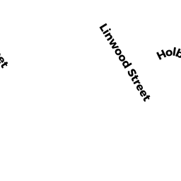
16 MERRILL LANE
Owner Information
BURGESS SCOTT
16 MERRILL LANE
HOLBROOK, MA 02343


Property Details
16 MERRILL LANE is classified as a Single Family Residential (Old style).
The primary structure on this property was built in 1850. There are 1,218ft2 of built area within this property. There is 1,218ft2 of residential/living space within this property. This property is listed as having 6 rooms.
16 MERRILL LANE is valued at $254,400. The land is valued at $78,600 and the structures are valued at $175,200. There is an additional valuation of $600 on this property.
This property is in Zone B1. Confirm with local Zoning Board authorities to ensure there are no overlays or other easements on this property.
The most recent deed for 16 MERRILL LANE is recorded at the local registrar in Book 34542, Page 493. 16 MERRILL LANE was last sold on Thursday, October 6, 2016 for $59,850.
Assessment data from fiscal year 2018.
Flood Data
This property is partially within the AE Zone (within floodplain). Approximately 0.17 acres (92.29%) of the property is within this zone.
A portion of this property is denoted as being within a floodway.
This information is sourced from the FEMA National Flood Hazard Layer. See our full disclamer.
Broadband Internet Providers
| Provider | Type | Bandwidth (mbps) | |
|---|---|---|---|
| Viasat Inc | Satellite | 100 | 3 |
| Verizon New England Inc. | DSL | 5 | 0 |
| Verizon New England Inc. | Fiber | 940 | 880 |
| Comcast | Cable | 1000 | 35 |
| GCI Communication Corp. | Satellite | 0 | 0 |
| HughesNet | Satellite | 25 | 3 |
| VSAT Systems, LLC. | Satellite | 2 | 1 |
Broadband service provider data from December 2020.
Adjacent Properties
- 8 MERRILL LANE
Single Family Residential owned by MERRILL LANE REALTY TRUST - 17 HILLVIEW AVE
Single Family Residential owned by BOWDEN ALISON A + - 894 S FRANKLIN ST
Single Family Residential owned by GANGEMI ANTHONY J + LINDA L - 36 RICHARD RD
Single Family Residential owned by QUINN DANIEL P + - 35 RICHARD RD
Single Family Residential owned by AVITABLE SCOTT K + AMY L - 900 S FRANKLIN ST
Single Family Residential owned by MATHIEU RASOUMIE PIERRE + - 912 S FRANKLIN ST
Two-Family Residential owned by FRAGA KEITH E